There are 2 seasons up Nort’, Winter and Road-Construction. Since it is arguably not Winter, check these sites for any construction updates or closures on your route:
Hwy 1 through Ely – 241 miles
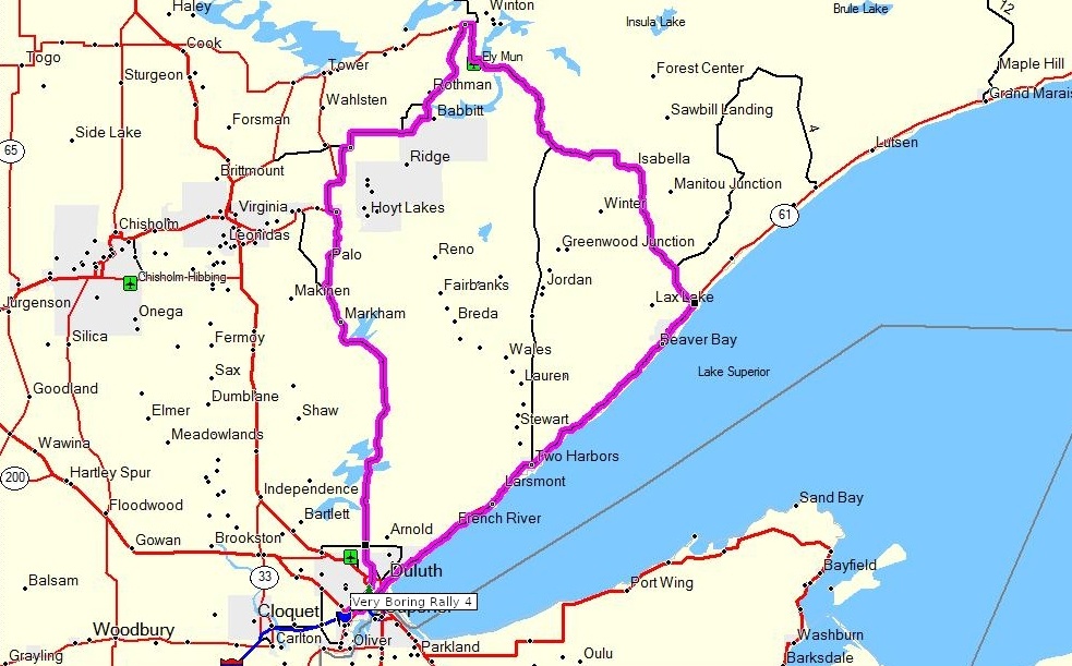
The North Shore of Minnesota has what no other place in the Midwest can offer — an inland sea, a mountain backdrop, an unspoiled wilderness, and a unique feeling all its own. The North Shore is a place that you will want to come back to again and again. Bisecting the rugged, heavily forested Arrowhead region, Minnesota Highway 1 runs for 68 miles between the North Woods outpost of Ely and Crystal Bay on Lake Superior. Special attractions: International Wolf Center and Dorothy Molter Museum in Ely; sharply rolling forest, cold water streams, and pristine lakes in Superior National Forest and Finland State Forest.
Skyline Loop – 33 miles

Overlooking the lovely port city of Duluth, the Skyline Parkway offers travelers a rewarding, bird’s-eye view of the harbor and the endless shoreline of Lake Superior. Recreational opportunities on neighboring trails and in local parks make this drive especially refreshing. Enjoy hiking, cross-country skiing and picnic areas along the way. At the northern end of the Byway, Hawk Ridge is an excellent vantage point for watching migratory birds in spring and fall.
Update: Skyline Parkway is closed at Hawk Ridge–there is no access to Seven Bridges Road from the North. You can still access Seven Bridges Road from the South at Superior St. and Occidental Blvd.
History of Skyline Pkwy
Google Maps
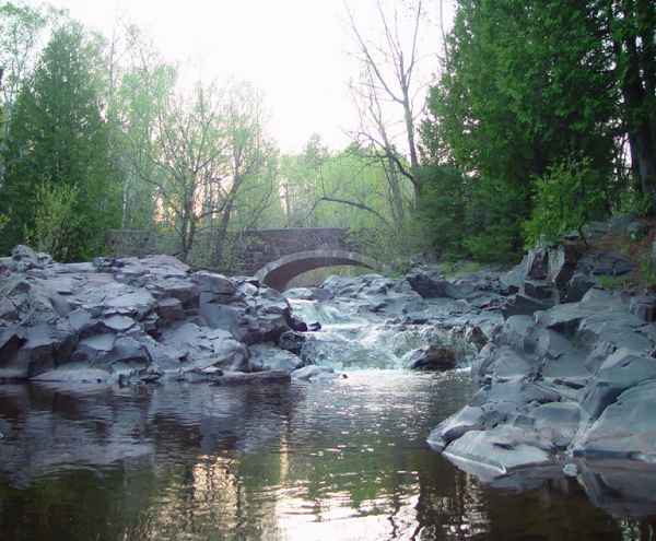
On This Route: Seven Bridges Road
One of the more beautiful parkways in Duluth, it crosses several beautifully crafted stone-arch bridges, all similar in design and construction, and the reason for the road’s name. Winding its way through approximately 4 miles of pine and birch forests, the lower portion of the road intertwines with Amity Creek, the western branch of the Lester River, as the waterway descends toward Lake Superior. Work on the parkway began in 1899 and originally contained 10 bridges.
Jay Cook/Oliver Ride – 40 miles
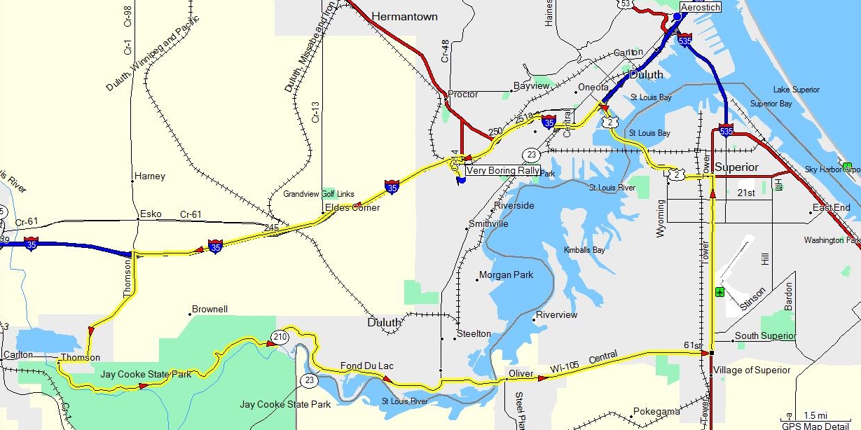
Hike the historic Grand Portage of the St Louis River. Peer over the swinging bridge at the dramatic rocky river gorge below or pause for a moment in the pioneer cemetery. The road and vistas make this park a motorcyclists dream.
Jay Cooke State Park: This 7 mile scenic ride is full of amazing twisties (30? 40?)! Lush forests form natural canopies along this road that follows a white water river and cuts through the upper half of Jay Cooke State Park. Absolutely beautiful.
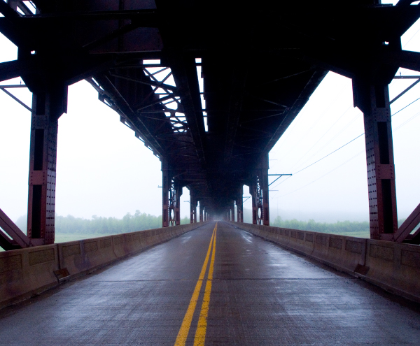
On This Route: Oliver Bridge
Originally made of wood, this charming structure is 1,900 feet long and is now made primarily of steel truss and reinforced concrete construction. The upper deck carries a single-track rail line while the lower deck carries the road connecting Wisconsin Highway 105 to Minnesota State Highway 39 over the St. Louis Bay.
Bayfield Scenic Loop – 191 miles
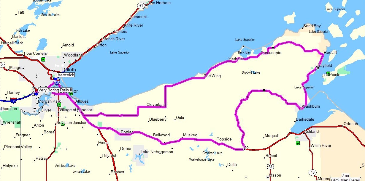
This is one of Northern Wisconsin’s most beautiful rides. US Hwy2 will take you through some historic towns such as Brule and Iron River. About 11 miles past Iron River turn left on Forest Road 236 for one of the nicest and twisty scenic roads in Northern Wisconsin. This route will take you through the Lake Superior Fishing Villages of Washburn, Bayfield, Cornucopia, and Herbster.
Headwaters of the Mississippi River Route (Itasca State Park) – 388 miles
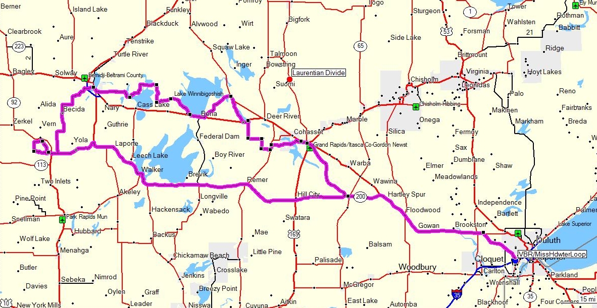
This ride will take you along MN Hwy 200 to Itasca State Park. Established in 1891 Itasca, is Minnesota’s oldest state park. Today, the park totals more than 32,000 acres and includes more than 100 lakes. Walk across the mighty Mississippi as it starts its winding journey 2,552 miles to the Gulf of Mexico. Then follow the Great River Road up to Bemidji, MN to Grand Rapids, MN and back to the rally site.